From Hallowes to Chantilly: Archaeology, Conflict, and Continuity on Currioman Bay
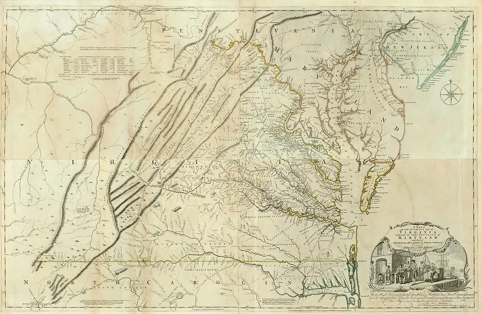
Along Currioman Bay in Westmoreland County, archaeology preserves two distinct chapters in the history of Virginia's Northern Neck. The first is associated with John Hallowes, an English immigrant who arrived in Maryland as an indentured servant and became a wealthy landholder and public official in Virginia. The second centers on Chantilly, the eighteenth-century home of Richard Henry Lee, a leader of the movement for American independence.
These histories are connected by land, but the archaeological sites should not be confused. The John Hallowes Site is recorded as 44WM6, while Chantilly is recorded separately as 44WM1. The fortified earthfast dwelling excavated at 44WM6 was occupied during the mid-seventeenth century. The Chantilly manor house belonged to a later Lee-period landscape. Virginia's Department of Historic Resources identifies Chantilly as occupying land that had originally formed part of John Hallowes's 1650 patent, creating a documented link between the two places without making them the same site.[1]
Together, Hallowes and Chantilly reveal how one landscape changed across more than a century: from a contested colonial frontier shaped by movement around the Potomac River to an eighteenth-century plantation associated with one of Westmoreland County's best-known Revolutionary leaders.
John Hallowes and the early Potomac world
John Hallowes was born in Lancashire, England, in 1615. In 1634, at approximately nineteen years old, he traveled to Maryland aboard the Ark as an indentured servant to Thomas Cornwallis. After completing his term of service in 1639, Hallowes married Restitute Tew and established himself in Maryland as a mariner, carpenter, trader, and landholder.[2]
His career developed within a lower Potomac region that did not yet conform to the later political and cultural boundaries between Maryland and Virginia. People, livestock, tobacco, trade goods, and information crossed the river regularly. Native communities maintained their own political and economic networks, while English colonists competed for land and authority. Europeans also brought systems of bound labor that included indentured servitude and, increasingly, racialized slavery. The lower Potomac was therefore not a peripheral boundary. It was a connected and contested zone in which Native, European, and African lives became entangled.
The period was also marked by conflict among English colonists. During Ingle's Rebellion of 1645-1646, Protestant insurgents challenged Maryland's proprietary government. Documentary evidence places Hallowes among the rebels. After the proprietary government regained control, Hallowes took an oath of fealty to Lord Baltimore in January 1647. By September, records identified him as being "of Appamattucks" on the Virginia side of the Potomac.[2]
The reassessment of 44WM6 interprets Hallowes's move as part of a broader migration of former Maryland rebels into the Nomini Bay area. Although the surviving records do not state his personal motives, political division, the possibility of retaliation, economic opportunity, and relationships among former rebels all provide important context for the move.[2] This interpretation replaces a simpler story of steady English expansion with one of displacement, factional conflict, and continued ties across the river.
The Hallowes Site, 44WM6
The Hallowes Site lies near Currioman Bay and Hollis Marsh, close to the Potomac River. Archaeologists first identified it in 1968, before construction in the Stratford Harbour development. William T. Buchanan Jr. directed excavations from July 1968 through August 1969 with Edward Heite, Virginia Sherman, and a small volunteer crew. More than 4,000 artifacts, in addition to thousands of animal remains, were recovered.[3]
The excavations revealed a post-in-ground, or earthfast, building approximately 20 by 50 feet. The house had an off-center brick chimney and corner bastions at opposing ends. These projecting defensive features made the building one of the rare documented fortified domestic compounds on Virginia's Northern Neck.[3]
For decades, researchers associated the fortifications with Susquehannock raids and the unrest preceding Bacon's Rebellion in 1676. That explanation depended on a late-seventeenth-century date for the house. A systematic reanalysis conducted from 2010 to 2012 by Lauren K. McMillan, D. Brad Hatch, and Barbara J. Heath revised the site's occupation to 1647-1681, approximately thirty years earlier than previously believed.[4]
The earlier chronology changes the meaning of the architecture. The researchers argue that the fortified house more likely belonged to the site's first phase and should be considered in relation to the political violence surrounding Ingle's Rebellion, the relocation of Maryland rebels, insecurity within the early colonial frontier, and Hallowes's own previous experience of conflict.[2][4] Archaeology does not preserve a written statement explaining why the bastions were constructed. The interpretation is instead built from the combined evidence of architecture, documentary history, artifact dates, and regional settlement patterns.
How archaeologists dated the site
Because no full excavation report was completed in the late 1960s, later researchers had to reconstruct the site's chronology from surviving notes, photographs, records, artifacts, and animal remains. They did not rely on a single diagnostic object. Instead, they compared several independent forms of evidence.
Historical records establish a likely beginning in 1647, when Hallowes relocated to the Virginia side of the Potomac, and an end in 1681, when the Westmoreland County court allowed John Manley to remove tenants from the property. Artifact-based methods supported that documentary range. The assemblage produced an adjusted mean ceramic date of 1667, a pipe-stem date of 1660, and a terminus post quem of 1675. With the exception of two later ironstone sherds identified as intrusive surface finds, the artifacts fit the proposed 1647-1681 occupation.[3][4]
The study is an important example of why archaeological dating is cumulative. Mean ceramic dates estimate the central tendency of a ceramic assemblage. Pipe-stem analysis uses changes in bore diameter over time. A terminus post quem, or TPQ, identifies the earliest possible date for a deposit based on its most recently manufactured artifact. Documentary evidence then provides dates associated with known people and events. When these methods converge, the result is more reliable than a date based on one artifact alone.[4]
Researchers identified at least two major phases at 44WM6. During the first, beginning around 1647, the main dwelling and its bastions were constructed and occupied by Hallowes's household and later by his widow Elizabeth and her second husband, David Anderson. After the Andersons left for Stafford County around 1666, tenants likely occupied the property. The bastions were removed or abandoned, fences were added, and a possible addition may have altered the east side of the house before occupation ended in 1681.[2][3]
What the artifacts reveal
The Hallowes assemblage contains ceramics, tobacco pipes, bottle and table glass, metal objects, architectural materials, gunflints, lead shot, and animal bone. These objects place the household within local, intercolonial, and Atlantic networks.
Ceramics formed the largest artifact category. Morgan Jones ware, a locally produced coarse earthenware, was especially abundant. Imported ceramics included North Devon wares, Rhenish stoneware, tin-glazed earthenware, and less common wares from continental Europe. Clay tobacco pipes included imported English and Dutch examples as well as locally made pipes. Some local forms have parallels at Native and colonial sites elsewhere in the Potomac Valley.[2][3]
The animal remains add another dimension. Cattle and pig were the most common identified domestic animals, but deer represented a substantial portion of the assemblage. The anatomical pattern of the deer remains led Hatch to argue that Hallowes participated in the deerskin trade and received selected portions of butchered animals through exchange with Native people.[3] Combined with documentary references to Hallowes's trade with local Algonquian communities, the faunal evidence shows that the household's economy cannot be understood as isolated or exclusively English.
The artifacts do not describe encounters in a simple or peaceful way. Trade, diplomacy, coercion, violence, and dispossession existed together. Hallowes participated in colonial expansion and accumulated more than 5,000 acres, while records also document his commercial relationships with Native people.[2] The site therefore offers evidence of interaction without erasing the unequal power and land loss that accompanied English settlement.
From the Hallowes patent to Chantilly
The occupation at 44WM6 ended in 1681, but the history of the land continued. The property remained with Hallowes and Manley descendants until 1722, when Samuel Hallowes, a distant relative living in England, successfully claimed it. In 1733 he sold the land to Thomas Lee of Stratford Hall. The archaeological reassessment states that the property then remained within the Lee family's holdings until 1838.[2][4]
Virginia DHR describes Chantilly as originally part of John Hallowes's 1650 patent. Richard Henry Lee leased the property from his elder brother, Philip Ludwell Lee, and established Chantilly as his residence by the early 1760s. He lived there until his death in 1794.[1]
This chain of ownership explains the connection between the two subjects, but chronology and site numbers preserve an essential distinction:
Place | Archaeological designation | Principal period discussed | Historical association |
Hallowes Site | 44WM6 | ca. 1647-1681 | John Hallowes, his family, and later tenants |
Chantilly | 44WM1 | principally the later eighteenth century | Richard Henry Lee and the Lee family |
The seventeenth-century fortified Hallowes dwelling was not Richard Henry Lee's Chantilly manor house. Chantilly represents a later use of land within the earlier patent landscape.
Richard Henry Lee at Chantilly

Richard Henry Lee was born at Stratford Hall in 1732 and made Chantilly his home around the time of his marriage to Anne Aylett. From Chantilly, he participated in county, colonial, Revolutionary, and national politics. He served in the House of Burgesses, the Continental Congress, the Confederation Congress, and the United States Senate. In June 1776, he introduced the resolution in the Continental Congress declaring that the colonies "are, and of right ought to be, free and independent States."[1][5]
The Chantilly house no longer stands. A late-eighteenth-century description characterized it as more comfortable than elegant and noted its view across the bay. A 1794 inventory recorded a dining room, library, parlor, bedrooms, store rooms, and closets, as well as a kitchen, dairy, blacksmith shop, stable, and barn. The house was in ruins by 1845. Archaeological work begun in 1967 located part of its foundations.[5]
Chantilly was listed in the Virginia Landmarks Register in 1970 and the National Register of Historic Places in 1971. It is an archaeological site on private property, not a surviving plantation house open for public visitation.[1]
One landscape, many histories
The relationship between Hallowes and Chantilly is not simply a chain from one prominent man to another. It is a record of how land along Currioman Bay was claimed, inhabited, exchanged, inherited, worked, and reinterpreted.
At 44WM6, archaeology documents an earthfast household on a politically unstable frontier. Its fortified plan reflects fear and conflict; its ceramics and pipes trace regional and Atlantic exchange; and its animal remains suggest sustained economic interaction with Native communities. Chantilly, on land later incorporated into Lee holdings, represents an eighteenth-century plantation landscape tied to Revolutionary politics. Both places also depended upon labor systems that require continued research, including indentured service, tenancy, and the lives and labor of enslaved Africans and African Americans.
The Hallowes Site is especially valuable because its revised chronology changes the questions historians ask. Rather than treating the house primarily as a response to events in the 1670s, researchers can examine it as part of the upheaval that carried former Maryland rebels into the Northern Neck in the 1640s. Rather than viewing the Potomac as a border, the evidence presents it as a corridor connecting people, goods, and conflicts. Rather than collapsing Hallowes and Chantilly into a single place, archaeology allows us to see two separate sites within a changing historical landscape.
Research Westmoreland County history
The Westmoreland County Museum preserves and interprets the people, places, and material culture that shaped the county. Researchers interested in John Hallowes, Chantilly, Richard Henry Lee, Currioman Bay, the Northern Neck, and local archaeology are encouraged to explore the resources of the Henry Hungerford Library & Genealogical Research Center and the Museum's research collections.
Visit the Westmoreland County Museum to learn more about Westmoreland's colonial and Revolutionary history. Follow and share our research to help preserve the county's archaeological record and make local history accessible to future generations.
Sources and further reading
Virginia Department of Historic Resources. “Chantilly (096-0005).” Updated April 29, 2024. https://www.dhr.virginia.gov/historic-registers/096-0005/
Hatch, D. Brad, Lauren K. McMillan, and Barbara J. Heath. Archaeological Reassessment of the Hallowes Site (44WM6). Report prepared for the Virginia Department of Historic Resources. Knoxville: University of Tennessee, Department of Anthropology, 2013.
“The Hallowes Site (44WM6).” Colonial Encounters: The Lower Potomac River Valley, 1500-1720 AD. https://colonialencounters.org/SiteSummaries/HallowesSummary.aspx
McMillan, Lauren K., D. Brad Hatch, and Barbara J. Heath. “Dating Methods and Techniques at the John Hallowes Site (44WM6): A Seventeenth-Century Example.” Northeast Historical Archaeology 43 (2014): 151-169. https://doi.org/10.22191/neha/vol43/iss1/8
National Park Service. National Register of Historic Places Inventory-Nomination Form: Chantilly (Richard Henry Lee House Site). 1971. https://www.dhr.virginia.gov/wp-content/uploads/2018/04/096-0005_Chantilly_1971_Final_Nomination_REDACTED.pdf